
A warming climate has been helping drive a global rise in sea levels. A new analysis now finds that hundreds of major studies missed just how much sea levels have risen. Past estimates were too low, the new study shows. On average, true sea levels are 20 to 30 centimeters (8 to 12 inches) higher than what past studies reported.
This means that the toll of future sea level rise is even greater than expected.
Katharina Seeger and Philip Minderhoud did the research. They work at Wageningen University in the Netherlands. These physical geographers evaluated data from 385 global and regional studies. All had been published between 2009 and 2025.
Explainer: Why sea levels aren’t rising at the same rate globally
Some 99 percent of the studies had incorrectly estimated ocean height, they found. And 45 of the studies were used a few years ago in a major report. It was issued by a global panel of climate experts convened by the United Nations.
Knowing the rate of ocean rise is crucial for coastal planners around the world. It helps them predict when sea water will start to flood — and permanently cover — large swaths of land. The errors in past studies, the researchers say, mean that coastal land may disappear faster than expected. In some places, it could vanish as much as a century sooner than thought.
The team shared its findings in the April 16 Nature.
A one-meter (39-inch) rise in sea level — which could happen within a century — could submerge an area more than 30 percent bigger than scientists thought. That would take away land from 77 to 132 million people. That’s 48 to 68 percent more people than previous estimates.
Sea level rise is slow. But it’s also dangerous if you ignore it, says Anders Levermann. “That’s basically what we’ve done, unknowingly,” he says. “These estimates now tell us that we are much further in the future than we thought we were.” A climate scientist, Levermann works at the Potsdam Institute for Climate Research in Germany.
One problem: geoids
Some of the analyzed studies had focused on sea level rise. Others had focused on storm surges, tsunamis or other coastal hazards. And a common mistake emerged in nine out of every 10 of the studies, the researchers say.
It had to do with the type of data used.
Researchers usually gauge coastal flood hazards by comparing a site’s land elevation to sea levels. Ideally, those sea levels come from actual measurements. Those can come from satellites. Or they could be from tidal gauges, ocean buoys or other tools.
But few of the studies Seeger and Minderhoud reviewed had included such direct sea-level measurements. Instead, the studies had relied on wonky, digital shapes called geoids (GEE-oids).
Geoids are imaginary shapes. They’re meant to approximate Earth’s sea level. They don’t show big ice sheets or giant mountain peaks. Instead, they show Earth as a sort of irregular ball of water with an undulating surface.
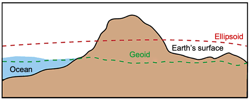 This image shows how two average global surface models can vary from Earth’s actual land elevations and sea level. The geoid model (green hashed line) appears lower than the ocean height and far lower than an alternative ellipsoid model (red hashed line).USGS; adapted by L. Steenblik Hwang
But there are two key problems to using geoids to gauge sea level, Seeger and Minderhoud say. First, geoids can be off by several meters. Gravity data are key for making geoids. So geoids are less accurate where gravity data are poor. Those areas include the Global South.
Second, geoids do not account for many other things that can affect sea level. These include ocean circulation and currents. Winds, tides and water temperatures also play roles.
It’s possible to correct for these geoid problems, Minderhoud said at a March 3 news briefing. But the new research shows that few scientists studying coastal hazards make those fixes.
Geoid assumptions led to errors in 90 percent of the reviewed studies. Another 9 percent did not align measurements of sea level and land elevation properly. Fewer than one percent of the studies properly aligned such data, Seeger said.
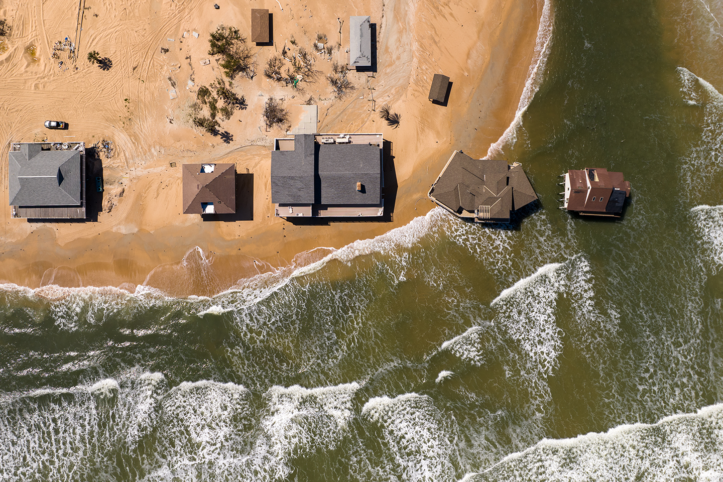 A drone view of these homes in Summer Haven, Fla., show they are already so close to sea level — and at times partially below it — that they can easily be washed away as sea levels continue to climb. Aerial_Views/E+/Getty Images Plus
Average errors varied by region
To see how far off sea-level numbers had been in most studies, Seeger and Minderhoud turned to satellite data. These data measured sea-surface heights globally. Compared to these, geoid-based studies had underestimated coastal sea level by an average of 24 to 27 centimeters (about 10 inches).
Errors were more than three times that size for some places. Among these were parts of Southeast Asia and the Indo-Pacific.
For a few places, estimates of sea levels had actually been too high. These regions included the northern Mediterranean and Antarctica. That was also true for some islands in the Atlantic and Pacific.
Study estimates were closest for eastern North America and northern and western Europe. Overall, though, most measured sea levels were higher than what past studies had published.
This means the advance of the oceans “is even worse than what’s been reported,” says Patrick Barnard. A coastal geologist, he works at the University of California, Santa Cruz. The new work, he says, is important for planners. It suggests they should be cautious when using findings from big-picture studies to guide local efforts to adapt to sea level rise.
To help future studies, Seeger and Minderhoud have publicly shared coastal sea-level data. These include the most recent actual measurements.


 Bengali (Bangladesh) ·
  English (United States) ·